Is a smart city project feasible? The digital twin has the answer
Discover how the digital twin makes future smart cities that adopt it thrive rapidly and without obstacles.
Is a smart city project feasible? The digital twin has the answer
Discover how the digital twin makes future smart cities that adopt it thrive rapidly and without obstacles.
Smart city projects: from urban growth to citizen well-being
The term Smart City is often used incorrectly to describe the city of the future in science fiction terms. However, this is not what is behind the smart city. Let us reiterate what is meant by this debated concept.
Smart city is a city that manages and delivers public services by making use of new technologies to improve livability within it. Indeed, there is a high level of connectivity at the base and extensive use of Artificial Intelligence. There are also green spaces and there is efficient waste cycle management.
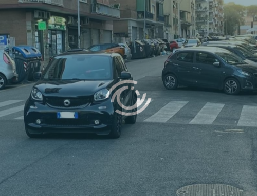
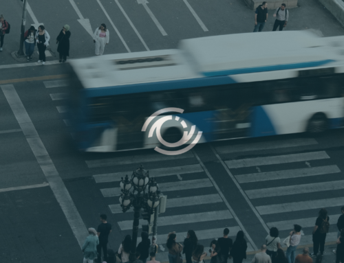
A myriad of data are collected in the smart city, for example on traffic and parking location and availability. The continuous collection of this and other data helps improve services in real time. In addition, it enables administrations to manage urban spaces more and more efficiently.
Smart city development also sees citizen participation. These are included in the design and execution phases of urban policies that involve them.
In essence, a city is smart when it is able to adapt itself to the needs of its population while also promoting sustainable development.
Does every smart city achieve this goal unhindered? What if, on the other hand, all the issues involved in the design of a smart city could be known in advance?
Digital twins as the basis of smart city projects
Current urban design and management approaches are unable to interact directly with the city and anticipate possible problems in their implementation. The idea of using digital twins in urban planning was born to solve this problem. Let’s find out what it is all about.
Digital twin refers to a virtual representation of a physical system that is updated through the exchange of information between the physical and virtual systems.
Originally developed for industrial systems, this concept is applied in the urban context because of its ease of use. Indeed, this enables smart solutions to achieve sustainable cities through the potential of, for example, the Internet of Things, Big Data, and Virtual and Augmented Reality.
Several urban digital twins have currently been developed and these are set to grow. This is because they are seen as useful for cities that are rapidly growing. In addition, it is linked to the achievement of the Sustainable Development Goals (SDGs) of the United Nations 2030 Agenda.
Digital twins essentially allow for the simulation of plans before they become concrete, highlighting problems before they become reality. Let’s find out how.
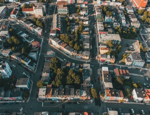
The urban digital twin includes the integration of different technologies. A 3D map of the city is used as the basis of urban digital twins. In the image and likeness of the city, a digital twin includes its component systems, such as road infrastructure. This is used to monitor and predict their operation even as environmental conditions change.
Precisely, the digital twin smart cities are enriched and integrated with data acquired from sensors. They detect parameters related to air, water, heat, etc. in real-time. In this way, they create highly reliable predictive models to gain awareness of the environmental context.
Thanks to this bridge between the physical and virtual worlds, it is possible to plan and develop projects, predicting their effects on the “twin” city. Thus it is easier to identify any problems in advance and intervene.
Another value brought by the Digital Twin emerges: the ability to contain costs. This allows the public administration to make thoughtful decisions, avoiding expenses in vain. This results in better urban management and a more sustainable city to the benefit of society.
In parallel, it also gives an opportunity to increase the involvement of local communities, who can see projects through virtual reality.
Digital twins in the world: the case of Milan
As we have already anticipated, today there are multiple cases of the digital twins in smart cities.
For example, Singapore has implemented Virtual Singapore, a 3D model for virtual simulations of mobility, climate, air pollution, etc. [1]
In Europe, the LEAD program is underway. It will create digital twins in 6 cities: Madrid, The Hague, Lyon, Budapest, Oslo and Porto. Its goal is to test innovative solutions to improve logistical challenges. [2]
We also have new digital twin projects in Italy. This is the case of the municipality of Milan in collaboration with the Dutch company Cyclomedia.
It has mapped more than 2,500 km of streets in Milan. This activity was aimed at supporting the development of Smart City applications.
Three camera-equipped vehicles took 25 days to map the streets of Milan. In detail, they covered the streets of each neighborhood, including areas never before analyzed, such as Citylife.

|
Source: Cyclomedia |
Through this activity, it was possible to create a real Digital Twin of the city. It includes street signs, traffic lights, barriers, and light poles. In addition to these, it also includes the size of bridge and tunnel crossings, number and size of shops, handicap ramps and much more.
This data, collected and processed using AI algorithms, will be useful for verifying and updating the municipality’s 22 geodatabases. In addition, they will be used to implement smart urban planning and enhance public spaces. [3]
So, the first step to becoming a smart city is to equip oneself with a data-enriched overview of the existing city. A Digital Twin makes it possible to navigate the territory to inspect its places digitally and quickly. Then, it can automatically identify all the assets in the public space.
Surely the cities that adopt such technology will be those that thrive in all respects.
References:
-
-
- Singapore Land Authority. Online version: https://www.sla.gov.sg/geospatial/gw/virtual-singapore
- Lead project. Online version: https://www.leadproject.eu/
- Comune Milano. Online version: https://www.comune.milano.it/-/digital-week.-pronte-le-basi-per-il-gemello-virtuale-della-grande-milano
-
© Copyright 2012 – 2023 | All Rights Reserved
Author: Rossana Cascione, Digital Marketing Specialist
Smart city projects: from urban growth to citizen well-being
The term Smart City is often used incorrectly to describe the city of the future in science fiction terms. However, this is not what is behind the smart city. Let us reiterate what is meant by this debated concept.
Smart city is a city that manages and delivers public services by making use of new technologies to improve livability within it. Indeed, there is a high level of connectivity at the base and extensive use of Artificial Intelligence. There are also green spaces and there is efficient waste cycle management.
A myriad of data are collected in the smart city, for example on traffic and parking location and availability. The continuous collection of this and other data helps improve services in real time. In addition, it enables administrations to manage urban spaces more and more efficiently.
Smart city development also sees citizen participation. These are included in the design and execution phases of urban policies that involve them.
In essence, a city is smart when it is able to adapt itself to the needs of its population while also promoting sustainable development.
Does every smart city achieve this goal unhindered? What if, on the other hand, all the issues involved in the design of a smart city could be known in advance?
Digital twins as the basis of smart city projects
Current urban design and management approaches are unable to interact directly with the city and anticipate possible problems in their implementation. The idea of using digital twins in urban planning was born to solve this problem. Let’s find out what it is all about.
Digital twin refers to a virtual representation of a physical system that is updated through the exchange of information between the physical and virtual systems.
Originally developed for industrial systems, this concept is applied in the urban context because of its ease of use. Indeed, this enables smart solutions to achieve sustainable cities through the potential of, for example, the Internet of Things, Big Data, and Virtual and Augmented Reality.
Several urban digital twins have currently been developed and these are set to grow. This is because they are seen as useful for cities that are rapidly growing. In addition, it is linked to the achievement of the Sustainable Development Goals (SDGs) of the United Nations 2030 Agenda.
Digital twins essentially allow for the simulation of plans before they become concrete, highlighting problems before they become reality. Let’s find out how.
The urban digital twin includes the integration of different technologies. A 3D map of the city is used as the basis of urban digital twins. In the image and likeness of the city, a digital twin includes its component systems, such as road infrastructure. This is used to monitor and predict their operation even as environmental conditions change.
Precisely, the digital twin smart cities are enriched and integrated with data acquired from sensors. They detect parameters related to air, water, heat, etc. in real-time. In this way, they create highly reliable predictive models to gain awareness of the environmental context.
Thanks to this bridge between the physical and virtual worlds, it is possible to plan and develop projects, predicting their effects on the “twin” city. Thus it is easier to identify any problems in advance and intervene.
Another value brought by the Digital Twin emerges: the ability to contain costs. This allows the public administration to make thoughtful decisions, avoiding expenses in vain. This results in better urban management and a more sustainable city to the benefit of society.
In parallel, it also gives an opportunity to increase the involvement of local communities, who can see projects through virtual reality.
Digital twins in the world: the case of Milan
As we have already anticipated, today there are multiple cases of the digital twins in smart cities.
For example, Singapore has implemented Virtual Singapore, a 3D model for virtual simulations of mobility, climate, air pollution, etc. [1]
In Europe, the LEAD program is underway. It will create digital twins in 6 cities: Madrid, The Hague, Lyon, Budapest, Oslo and Porto. Its goal is to test innovative solutions to improve logistical challenges. [2]
We also have new digital twin projects in Italy. This is the case of the municipality of Milan in collaboration with the Dutch company Cyclomedia.
It has mapped more than 2,500 km of streets in Milan. This activity was aimed at supporting the development of Smart City applications.
Three camera-equipped vehicles took 25 days to map the streets of Milan. In detail, they covered the streets of each neighborhood, including areas never before analyzed, such as Citylife.
|
Source: Cyclomedia |
Through this activity, it was possible to create a real Digital Twin of the city. It includes street signs, traffic lights, barriers, and light poles. In addition to these, it also includes the size of bridge and tunnel crossings, number and size of shops, handicap ramps and much more.
This data, collected and processed using AI algorithms, will be useful for verifying and updating the municipality’s 22 geodatabases. In addition, they will be used to implement smart urban planning and enhance public spaces. [3]
So, the first step to becoming a smart city is to equip oneself with a data-enriched overview of the existing city. A Digital Twin makes it possible to navigate the territory to inspect its places digitally and quickly. Then, it can automatically identify all the assets in the public space.
Surely the cities that adopt such technology will be those that thrive in all respects.
References:
-
-
- Singapore Land Authority. Online version: https://www.sla.gov.sg/geospatial/gw/virtual-singapore
- Lead project. Online version: https://www.leadproject.eu/
- Comune Milano. Online version: https://www.comune.milano.it/-/digital-week.-pronte-le-basi-per-il-gemello-virtuale-della-grande-milano
-
© Copyright 2012 – 2023 | All Rights Reserved
Author: Rossana Cascione, Digital Marketing Specialist


Awesome post.
Thanks to my father who informed me concerning this webpage, this blog is genuinely amazing.
What’s up all, here every person is sharing these knowledge, thus it’s nice to read this
weblog, and I used to visit this web site everyday.